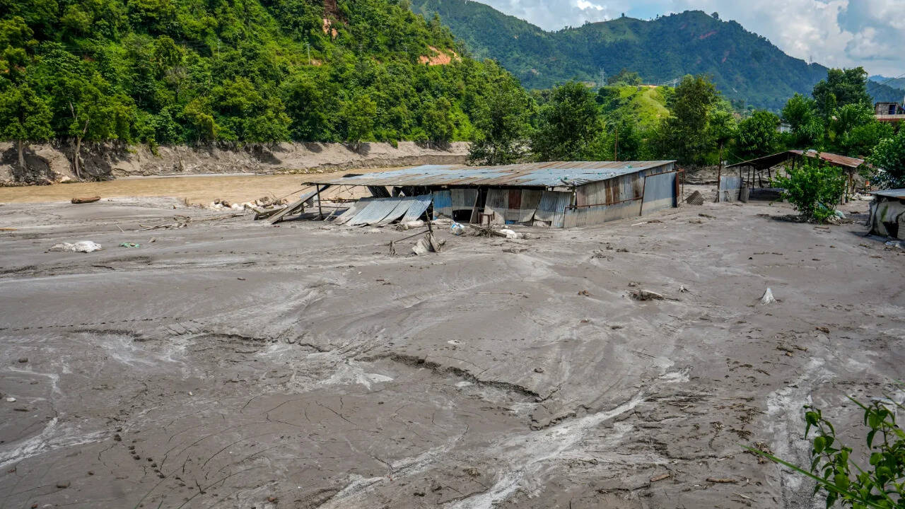
Standard hydrological forecasting models fail in high-altitude mountain environments because they assume water originates from predictable rainfall patterns rather than sudden cryospheric detachment. When catastrophic flash floods tore through the Nepal-China border region along the Trishuli River basin, destroying infrastructure and leaving thousands dead or missing, public discourse focused heavily on unexpected weather. Yet, the physical mechanism driving the destruction was not standard monsoon overflow. It was an ice-rock avalanche generated by high-altitude bedrock failure beneath a destabilized glacier. Regional scientific assessments published months prior had mapped precisely how accelerated thermal regimes were altering structural stability across the Hindu Kush Himalaya, yet operational disaster response frameworks remained anchored to seasonal precipitation paradigms.
The Mechanics of Cryospheric Collapse
The event sequence began with structural fatigue at the base of a high-altitude glacier rather than surface melt or heavy rainfall alone. Cryospheric analysis indicates that thermal erosion at extreme elevations weakens the interface between glacial ice and underlying bedrock. In this specific event, a deep-seated detachment occurred, releasing millions of metric tons of ice, rock, and debris down steep mountain corridors.
The physical transition from a static ice mass to a dynamic debris flow follows distinct mechanical thresholds:
- Elevation-Dependent Thermal Amplification: Warming rates at altitudes exceeding 4,500 meters outpace global averages, rapidly altering the internal thermal regime of permafrost and sub-glacial bedrock.
- Bedrock Shear Failure: The loss of supporting ice buttress structures, combined with subsurface water pressure, reduces the frictional resistance of the foundation, triggering massive mass-wasting events that register as high-magnitude seismic signals.
- Kinetic Energy Conversion: As the ice and rock cascade vertical drops spanning thousands of meters, potential energy converts into immense kinetic force, liquefying saturated valley sediments and turning the torrent into a high-density debris wave capable of obliterating reinforced structures.
This sequence invalidates conventional flood return-period calculations. Traditional risk management assumes gradual volume accumulation, allowing downstream warning systems hours or days to react. Bedrock-triggered ice avalanches compress response windows to minutes, shifting the disaster timeline past the threshold of human evacuation capabilities.
The Cascade Dynamics of Natural Dam Formation
Disaster evolution does not terminate with the initial impact wave; it enters a secondary phase characterized by hydraulic bottlenecks. When massive debris loads obstruct narrow river confluences, they create temporary barrier lakes. These unstable earthen dams introduce a compounding hazard function across international borders.
As inflows accumulate behind the debris barrier, hydrostatic pressure increases exponentially against an unengineered structure composed of loose boulders, mud, and ice fragments. The stability of these temporary impoundments depends entirely on the volumetric capacity of incoming upstream drainage versus the discharge rate of seepage or surface overflow. When inflow volumes exceed structural shear strength, the barrier fails catastrophically. This secondary breach releases an instantaneous surge wave that travels downstream with little to no advanced telemetry warning, endangering rescue personnel operating in the mud-choked valleys below.
The Failure Vector of Institutional Lag
The systemic vulnerability exposed along the Tibet-Nepal frontier stems from a temporal mismatch between scientific observation and institutional deployment. Research institutions like the International Centre for Integrated Mountain Development documented that regional glacier ice loss rates had doubled compared to late-twentieth-century baselines, explicitly identifying small glaciers below 0.5 square kilometers as high-risk hazards for localized outburst events.
However, translating static cryospheric inventories into dynamic, real-time operational protocols requires continuous sensor integration that mountain catchments currently lack. Telemetry networks measuring sub-surface temperature, pore water pressure, and micro-seismic activity remain sparse across high-altitude border zones. Consequently, emergency management agencies operate with high latency, reacting to catastrophic outcomes rather than monitoring precursor structural indicators. Cross-border river systems further complicate mitigation, as hydrometeorological data sharing between upstream sovereign territories and downstream populations often encounters diplomatic and infrastructural friction during rapidly evolving crises.
Strategic Execution for High-Altitude Risk Mitigation
To alter the casualty trajectory of future Himalayan disasters, institutional frameworks must abandon reactive flood-gauging models in favor of cryospheric stress monitoring. Infrastructure planning in high-relief mountain valleys requires structural setbacks based on kinetic runout models rather than historical water marks. Deploying automated acoustic and seismic sensor arrays directly beneath vulnerable glaciers provides the only viable method to capture bedrock detachment phases, buying crucial minutes for automated downstream alarm activation before a debris wave enters populated corridors. Regional authorities must establish unified cross-border protocols that treat high-altitude debris flow tracking as a continuous operational priority rather than a seasonal review.