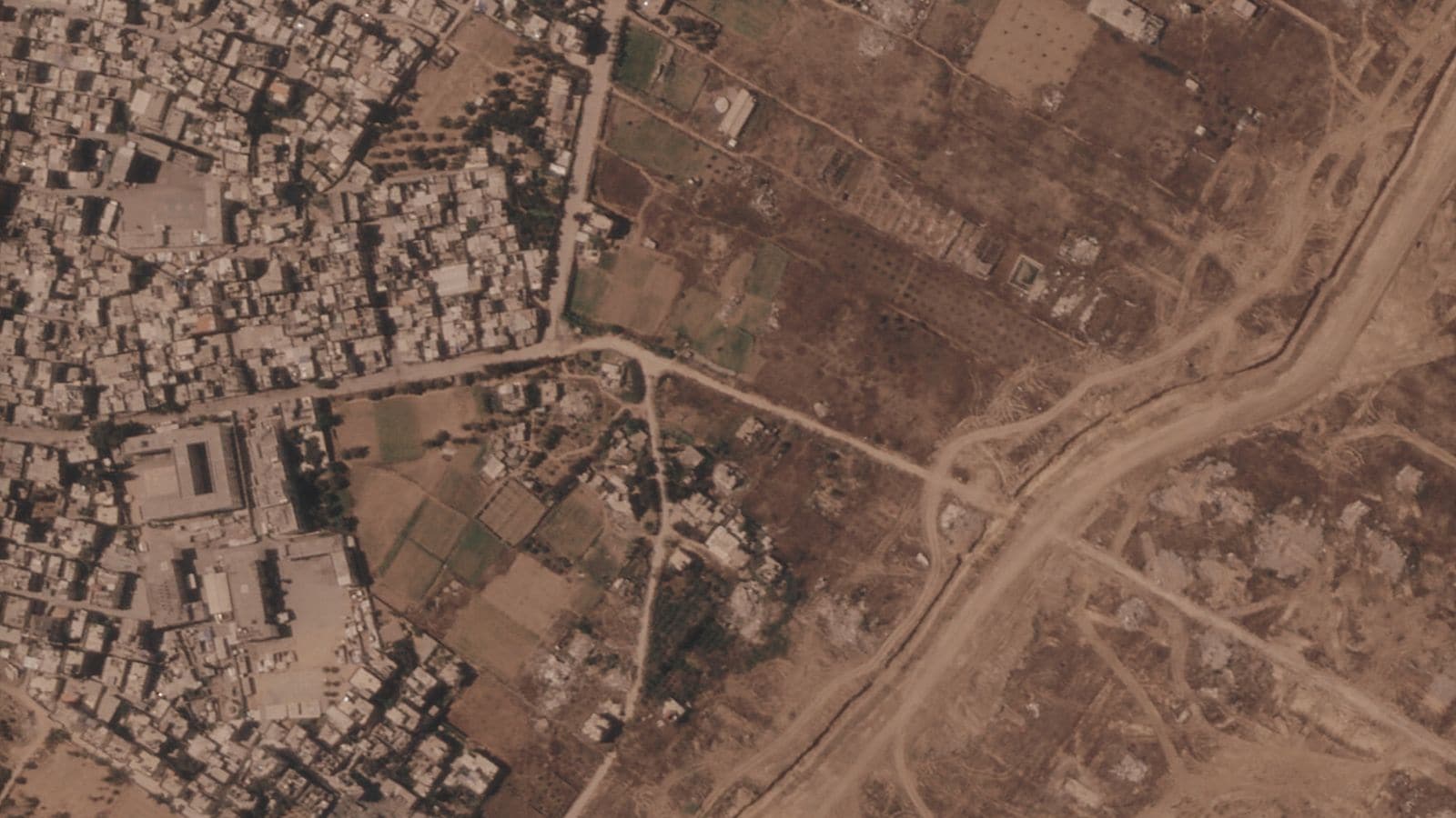
Satellite imagery and ground reports reveal that the Israeli military is constructing a massive network of earthen barriers, deep trenches, and paved access corridors across the Gaza Strip. This physical transformation effectively divides the territory into isolated sectors while establishing a semi-permanent military footprint. What initially began as temporary combat maneuvers has rapidly evolved into heavy civil engineering, shifting the geometry of the conflict zone. By pushing millions of tons of soil into continuous ridges, engineers are creating defensible perimeters that alter civilian movement, restrict agricultural access, and establish long-term control over strategic sightlines without relying solely on traditional concrete fortifications.
The Engineering Behind Civil Division
Heavy machinery, including armored bulldozers and excavators, operates around the clock to reshape the terrain. The mechanics are simple yet transformative. Engineers carve wide trenches parallel to engineered ridges, creating physical obstacles that prevent vehicular transit while offering fortified firing positions for military assets.
These earthworks follow precise topographical routes. Rather than relying entirely on existing roads or urban grid structures, the new barriers cut directly through fields, groves, and ruined residential blocks to secure elevated sightlines.
- Height and Scale: Earthen berms frequently reach heights of three to five meters, backed by excavated ditches of equal depth.
- Buffer Zones: Wide swathes of land on either side of the berms are cleared of vegetation and structures to maintain clear fields of fire.
- Access Corridors: Paved, heavy-duty logistics routes run adjacent to the earthworks, allowing rapid troop displacement across the divided zones.
By cutting off east-west and north-south movement corridors, these earthworks force all civilian and humanitarian traffic through tightly monitored transit checkpoints. The physical division of the land transforms temporary military positions into enduring geographical realities.
The Strategic Function of Physical Realignment
Military command structures favor earthworks for several tactical reasons. Unlike concrete walls, which require extensive manufacturing, transport, and setting time, earthen berms can be raised rapidly using local materials already on site.
The primary operational goal centers on force protection and territory control. Berms shield vehicles from anti-tank guided missiles and small-arms fire while establishing elevated observation posts over surrounding lowlands.
"Creating physical depth through terrain manipulation reduces the troop strength needed to hold a perimeter, shifting the burden of defense from active patrols to static structural control."
This strategy drastically alters local agriculture and civilian infrastructure. Farmland converted into berms and buffer zones loses topsoil integrity, making future cultivation nearly impossible without extensive land restoration. Furthermore, critical water networks, power grids, and road systems are severed wherever these deep excavations cut across the landscape.
Comparative Infrastructure Impact
| Feature | Pre-Existing Grid | Engineered Earthworks |
|---|---|---|
| Primary Material | Asphalt, local soil, masonry | Compacted earth, crushed rubble, gravel |
| Permeability | Open municipal access | Restricted single-point transit |
| Tactical Advantage | Minimal elevation, vulnerable | Elevated sightlines, natural ballistic cover |
| Long-Term Impact | Supports commerce and transit | Fragmented communities, destroyed topsoil |
The Long-Term Consequences for the Region
The creation of fortified earthworks signals an ongoing operational presence that extends well beyond immediate tactical engagements. Once established, berms and buffer corridors serve as the backbone for semi-permanent infrastructure, including fortified staging bases, automated surveillance towers, and secured supply lines.
This physical fragmentation reshapes humanitarian logistics. Relief convoys face long detours along designated military corridors, while local populations remain restricted to designated sub-zones.
Rebuilding or removing these earthworks requires more than political agreements; it demands extensive civil engineering efforts, unexploded ordnance clearance, and massive soil remediation. The physical contours created by armored machinery today will define the human and operational terrain for years to come.