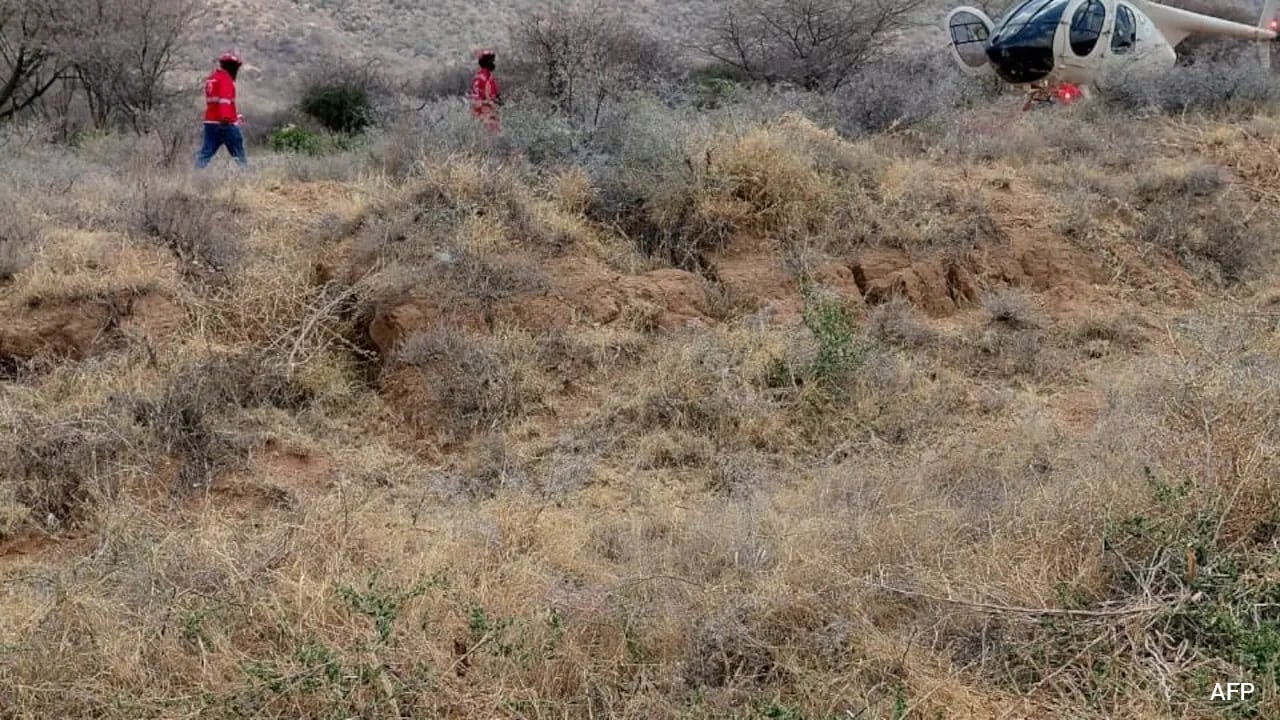
The fatal crash of a Eurocopter EC130 B4 in northern Kenya’s Samburu County, which resulted in seven fatalities including five United States citizens, highlights the complex risk vectors inherent to remote-location chartered aviation. Operating rotary-wing aircraft in geographically isolated conservancies demands an examination of structural variables, environmental hazards, and regulatory oversight frameworks that govern high-end adventure tourism.
This analysis deconstructs the operational parameters of bush-flying safety, the mechanics of accident causation in rugged topographies, and the systemic challenges facing regional civil aviation authorities. In other developments, take a look at: The Weight of a Single Envelope Inside the Canadian Immigration System.
The Operational Risk Matrix of Bush Aviation
Commercial charter operations in East Africa rely on rotorcraft to bridge infrastructure deficits. When ground transit is rendered unviable by unpaved road networks, seasonal flooding, or extreme distances, rotary-wing transport serves as the primary mobility vector for luxury eco-tourism. This operational model introduces distinct cost and risk functions.
Aircraft utilization rates in safari regions fluctuate heavily based on seasonal tourism peaks. High demand compresses maintenance windows and forces operators to maximize flight hours per airframe. The mechanical stress placed on turbine engines and rotor hubs operating in high-ambient-temperature environments accelerates component wear. Fine particulate matter, such as volcanic dust or sand common to northern Kenya, degrades compressor blades and compromises engine efficiency over time. Al Jazeera has also covered this critical subject in great detail.
Human factors compound mechanical variables. Pilots navigating remote conservancies operate without the redundancy of dense radar coverage or comprehensive instrument landing systems. Navigation relies heavily on visual flight rules within topographies characterized by sudden microclimates, thermal updrafts around inselbergs like Mount Ololokwe, and vast stretches of uniform terrain that induce spatial disorientation.
Topographical Hazards and Environmental Forcing Functions
The flight path between the Loisaba Conservancy and the Ewaso Nyiro basin traverses terrain defined by sudden elevation changes and severe wind shear. Rotary-wing performance degrades exponentially with increases in density altitude. When high ambient temperatures combine with elevated terrain, rotor efficiency drops, reducing the available power margin for emergency maneuvering.
Wind interactions with geological formations generate severe mechanical turbulence. Mount Ololokwe and surrounding escarpments create lee-side downdrafts capable of exceeding the vertical climb rate of light single-engine helicopters. If an aircraft enters a descending air mass near terrain boundaries, the recovery window narrows drastically.
Visibility restrictions present an additional environmental hazard. Early morning operations, such as the flight that departed at 9:13 a.m. local time, frequently encounter localized radiation fog or smoke from bushfires. When forward visibility drops below threshold requirements under visual flight rules, the risk profile shifts from operational management to crisis survival.
Fleet Dynamics and Airframe Vulnerability
The aircraft involved in the Samburu County incident, a Eurocopter EC130 B4, is an industry standard for passenger transport due to its spacious cabin configuration and Fenestron shrouded tail rotor. However, single-engine configurations lack the power redundancy of twin-engine platforms.
In the event of a sudden power plant failure or severe fuel starvation scenario, a single-engine pilot has a single opportunity to execute an autorotation maneuver. Successful execution depends heavily on three variables:
- Height-velocity envelope positioning at the moment of failure.
- Immediate terrain suitability for touchdown.
- Wind velocity vector relative to the descent path.
In the rocky, forested foothills of northern Kenya, flat terrain suitable for autorotation is scarce. Consequently, forced landings frequently result in catastrophic structural failure of the airframe, post-crash fire, and compromised survivability metrics for occupants.
Regulatory Oversight and Safety Infrastructure
The Kenya Civil Aviation Authority faces structural hurdles in monitoring remote operations. Oversight of decentralized airstrips and private conservancy helipads is constrained by logistical bottlenecks. Unlike commercial scheduled carriers monitored via flight data monitoring systems, charter operators often function with minimal real-time telemetry tracking outside of basic satellite flight-following units.
Search and rescue efficiency in these environments depends on the immediate activation of multi-agency response protocols. As demonstrated by the deployment of secondary operators like Tropic Air Kenya and the Kenya Red Cross, response latency is dictated by communication relay delays in cellular dead zones and the physical distance required for secondary assets to reach remote accident coordinates.
Strategic Industry Adjustments
Operators within the high-value tourism sector must recalibrate safety management systems to account for the unique vulnerabilities of remote-area flight operations. Fleet modernization efforts should prioritize twin-engine platforms equipped with modern terrain awareness and warning systems, synthetic vision technology, and automated flight tracking systems that transmit real-time diagnostic data over satellite networks. Risk mitigation in bush aviation requires structural investment in technological redundancy rather than reliance on pilot improvisation under adverse conditions.