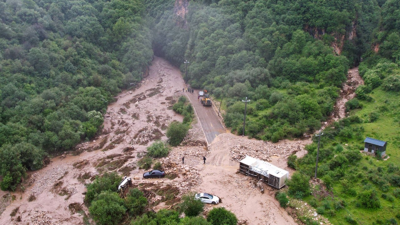
Flash floods in China's northwestern Gansu Province have raised the official death toll to 25, leaving dozens more injured as swollen rivers and torrential rainfall keep large swaths of the country on high alert. The disaster, which struck a popular valley and tourist area in Weiyuan County, underscores the growing exposure of inland regions to severe weather anomalies during the annual summer flood season. While coastal megacities typically dominate headlines for storm preparedness, interior provinces face distinct geographic hazards that complicate emergency coordination and rapid response.
Heavy summer rainfall is a recurring seasonal pattern across China, but the velocity and frequency of recent flash floods point to mounting infrastructural strain. Mountainous and semi-arid terrain, such as that found throughout Gansu, reacts to sudden cloudbursts with brutal speed. When intense precipitation hits dry, compacted earth, the soil fails to absorb the moisture quickly enough. Runoff funnels rapidly down valleys and ravines, turning dry creek beds into destructive torrents within minutes.
The Geography of Risk in Northwest Valleys
Topography dictates survival during extreme weather events. Valleys and low-lying basin areas frequently attract campers, tourists, and rural commerce due to their accessibility and water access. Yet these exact geographic features act as natural funnels during cloudbursts.
Consider a hypothetical mountain catchment basin measuring several square kilometers. When a high-intensity storm drops centimeters of rain over a short window, thousands of tons of water converge on a single narrow outlet. Human settlement patterns historically favor these low points for flat land and water supplies, creating a direct collision course between civil infrastructure and hydrological extremes.
Official reports confirm that the Gansu flash flood caught individuals off guard in a popular scenic zone. Rescue personnel deployed hundreds of vehicles and workers into the area, pulling survivors from debris fields littered with wrecked vehicles and fallen trees. However, the sheer distance between remote inland sites and major metropolitan emergency hubs often delays the initial deployment of heavy recovery equipment.
Beyond the Coastline
Disaster mitigation strategies have traditionally concentrated on eastern coastal zones vulnerable to typhoons and storm surges. Yet the inland provinces face an entirely different set of hydrological challenges.
- Topographical Amplification: Narrow valleys convert ordinary rainfall into high-velocity kinetic hazards.
- Soil Saturation Limits: Prolonged precipitation sequences reduce earth stability, triggering concurrent landslides.
- Communication Latency: Remote terrain frequently suffers from localized telecommunications outages during severe storms, slowing distress signals.
State media reports indicate that parallel weather alerts remain active across Beijing, Inner Mongolia, and southwestern regions like Sichuan, where hundreds of thousands of residents have faced seasonal relocation. The sheer geographic scale of these concurrent alerts tests the limits of national disaster relief coordination.
The Institutional Challenge of Early Warning
Deploying accurate warnings to rural and tourist-heavy regions remains a complex administrative hurdle. Meteorological observatories can track regional storm cells using satellite radar, but translating broad atmospheric data into hyper-local evacuation orders for a specific mountain valley requires precise ground-level integration.
Local authorities face a perpetual balancing act between economic disruption and public safety. Closing scenic areas or mandating preemptive evacuations during every heavy cloudburst forecast carries significant economic costs. Yet remaining open leaves civilian populations exposed to sudden, localized flash events that defy long-range prediction models.
As climate patterns shift and extreme precipitation events become more frequent, the margin for error narrows. Inland provinces require upgraded sensor networks along vulnerable river systems and stricter zoning enforcement in historical floodplains. Without these structural adjustments, seasonal rains will continue to extract a heavy human toll far from the eastern megacities.