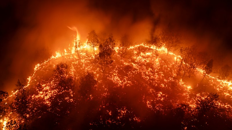
The wildfires choking Indonesian Borneo are not an act of sudden meteorological malice. They are the predictable mechanical output of drained peatlands, fragmented land titles, and a commodity system that treats smoke as an externality someone else has to breathe. When residents describe a sky turned rust-orange at noon, the visual shock is real, yet the deeper story sits below the surface—in desiccated organic soil that burns underground for weeks before breaking through the crust.
Anyone who has covered resource extraction across Southeast Asia for long enough recognizes the script. A dry spell arrives, El Niño nudges temperatures upward, and headlines focus on crimson horizons and emergency masks. By the following monsoon, attention drifts elsewhere, leaving intact the exact land-use incentives that turned spongy carbon sinks into tinderboxes.
What Actually Burns Under Indonesian Borneo
Surface grass and scrub burn fast and loud. Peat burns slow and dirty.
Across Kalimantan—the Indonesian portion of Borneo—millions of hectares consist of peatland, thick layers of partially decayed plant matter accumulated over thousands of years in waterlogged conditions. Left undisturbed, peat holds immense volumes of water and acts as a slow-release sponge. Once canals are dug to drain that water for agriculture, timber, or plantation access, the upper meter of peat dries out, oxidizes, and shrinks.
At that point, fire stops behaving like a normal brush blaze. Ignition can start from a discarded cigarette, a spark from land-clearing debris, or a stray ember jumping a ditch, and then drop straight into the carbon-rich soil. Underground smoldering—known as subsurface peat fire—can creep sideways for months at temperatures high enough to bake roots and sterilize microbial life while producing surprisingly little flame on top.
When peat burns underground, extinguishing it with surface water often fails. Hosing the top crust cools the lid while the core keeps cooking beneath a blanket of ash.
That physical reality explains why visibility collapses across whole districts even when satellite hot-spot counts look modest. A single smoldering pocket can pump dense particulates into stagnant air for weeks, turning midday light a bruised copper or blood red as shorter blue wavelengths scatter out of the beam.
The Canal Math Behind Every Dry Season
Look at a map of degraded Kalimantan concessions and you see straight lines cutting across natural watersheds. Those lines are drainage canals.
To plant oil palm, acacia pulpwood, or secondary cash crops on wet peat, operators historically needed to lower the water table. Lowering the water table exposes oxygen to organic matter that spent millennia without it. The soil subsides, sometimes by centimeters per year, making future flooding worse and requiring even deeper drainage.
Here is the trap nobody likes to admit in polite policy panels. Once a peat dome is drained past a certain threshold, rewetting it is technically tricky and politically messy. Blocking canals can flood neighboring smallholders whose houses, roads, or garden plots were built after the initial drainage. Leaving canals open keeps the peat dry, vulnerable, and primed for ignition every time rainfall dips.
Consider a hypothetical example to see how small actors get squeezed into the middle of large structures. Suppose a village family holds an informal cultivation claim beside a large concession boundary. A dry season hits, and clearing a small patch of scrub with fire seems like the cheapest way to prep soil before planting. A breeze carries sparks across a dry ditch into exposed peat. Within days, the family cannot put the fire out with buckets, the concession blames local burning, and regulators point at fragmented enforcement—while the underlying canal network remains untouched.
Why Smoke Crosses Borders While Accountability Stalls
Smoke does not respect concession boundaries or provincial lines. In severe episodes, plumes drift across the Java Sea, toward Malaysia, or out over the South China Sea, straining clinics and grounding flights.
Yet enforcement routinely bogs down in a maze of overlapping permissions. Land governance in Kalimantan has long wrestled with conflicting land claims, where customary community tenure, district-level permits, provincial spatial plans, and national forestry designations overlap on the same coordinates. When a fire breaks out on contested ground, pinning legal responsibility on a single entity turns into years of paperwork.
Satellite monitoring has improved dramatically. Agencies and researchers can spot thermal anomalies faster than ever, and supply-chain monitors can trace commodity flows with far greater precision than a decade ago. Still, knowing where heat appears is not the same as proving who lit the match or who profited from clearing the scrub. Shell structures, subcontracted land-clearing crews, and informal middlemen create distance between capital and torch.
Even well-intentioned corporate pledges hit friction on the ground. A buyer in Europe or North America may demand zero-burning commitments, and a processor may sign a sustainability charter. Out in the field, however, local contractors and smallholders operate under tight cash constraints, patchy extension services, and land rules that remain ambiguous in court.
The Health Cost Hides in Plain Sight
Red skies grab cameras. Chronic respiratory damage rarely makes a dramatic photograph.
During severe haze episodes in Indonesian Borneo, fine particulate matter—especially PM2.5—climbs far above levels considered safe by public health standards. Because these particles are tiny, they bypass upper-airway defenses and lodge deep in lung tissue, aggravating asthma, triggering cardiovascular strain, and hitting infants and older adults hardest.
Schools close for days or weeks at a time. Outdoor labor drops. Shopkeepers lose foot traffic while households spend scarce cash on bottled water, clinic visits, and makeshift masks that often offer minimal protection against ultrafine aerosols.
What frustrates public health specialists is the lag between exposure and recognition. Acute emergency-room visits spike during peak smoke weeks, creating visible strain on district hospitals. Long-term respiratory decline and lost school learning compound quietly over years, rarely showing up as a line item in land-clearing budgets.
Counter-Arguments and Uncomfortable Trade-Offs
Simplistic narratives treat every fire in Kalimantan as pure corporate malice or pure peasant recklessness. Neither captures the full picture.
On one side, environmental advocates rightly argue that draining deep peat for short-term commodity expansion is an ecological dead end. Peatlands store enormous carbon stocks, and burning them releases greenhouse gases at scales that dwarf many industrial smokestacks. From a pure conservation standpoint, restoring hydrology and halting peat conversion is non-negotiable.
On the other side, local officials and rural communities point to real economic stakes. Palm oil and timber derivatives have supported millions of livelihoods across Indonesia, funding local infrastructure, transport, and household incomes where alternative industries are scarce. Telling a district to freeze land use without credible transition finance sounds straightforward from a capital city office and hollow to a family with no other cash income.
There is also a practical tension in fire suppression itself. Aerial water-bombing looks decisive on news broadcasts, dropping thousands of liters in a pass. On deep peat, however, water dumped from altitude often sheets off hydrophobic dry surfaces or fails to penetrate compacted ash layers. Ground crews with portable pumps, localized water trenches, and patient mop-up work do the unglamorous labor that actually stops re-ignition—and those crews need water sources nearby, which drained canals often eliminate.
Practical Levers That Actually Move the Needle
Fixing recurring haze in Indonesian Borneo requires targeting the mechanics that make peat burnable in the first place, rather than treating every dry season like a brand-new surprise.
- Rewetting and canal blocking at watershed scale. Plugging drainage canals and raising water tables restores peat moisture so fire cannot easily travel underground. Where smallholders sit inside rewetted zones, programs have to pair hydrological restoration with alternative crop models or direct compensation rather than expecting compliance by decree.
- Resolving tenure before enforcing bans. Clear boundary mapping and recognition of customary and small-scale land rights reduce the gray zones where blame dissolves. People protect land they securely hold far more reliably than land they fear losing to a rival permit.
- Financing non-fire land preparation. Mechanical clearing, mulching, and community-shared equipment cost money upfront. Without subsidized access to machinery and practical training, small plots revert to the cheapest tool available: a match.
- Linking supply-chain transparency to local readiness. Buyers and financiers should push beyond paper audits toward funding local fire-brigade equipment, early-warning sensors, and community water retention ponds in high-risk districts.
None of these steps produces an instant headline victory. Rewetting takes seasons, tenure reform takes political spine, and community equipment needs maintenance long after a conference wraps up.
Yet the alternative is already visible whenever the wind shifts and the horizon turns red. Until drained peat is treated as an active hazard rather than cheap real estate, every dry spell in Indonesian Borneo will keep writing the same brutal story in smoke.