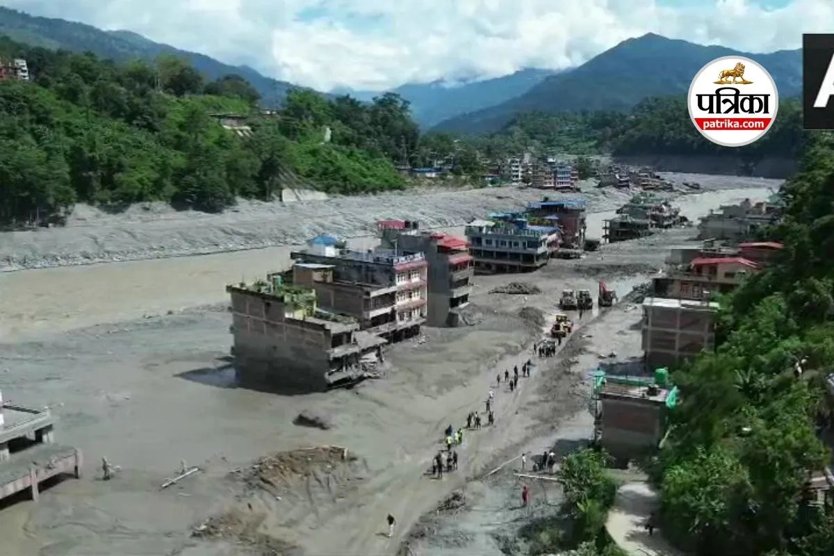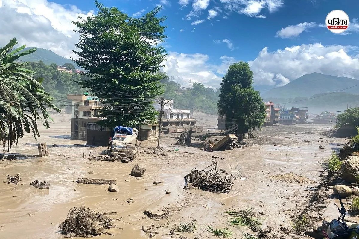
The catastrophic ice-rock avalanche that slammed into the Nepal-China border region, obliterating villages and hydropower infrastructure along the Lhende and Trishuli river valleys, was not an invisible strike from the blue. High-resolution orbital data captured by commercial and government satellite constellations in the days leading up to the disaster clearly tracked the destabilization of the Langtang-Lirung peak. The imagery showed surface fracturing, rapid snow cover loss, and accelerated mass movement. Yet, these precursory signals remained trapped in scientific dashboards and academic networks, failing to translate into operational evacuations for the thousands of construction workers, pilgrims, and residents living in the shadow of the peaks.
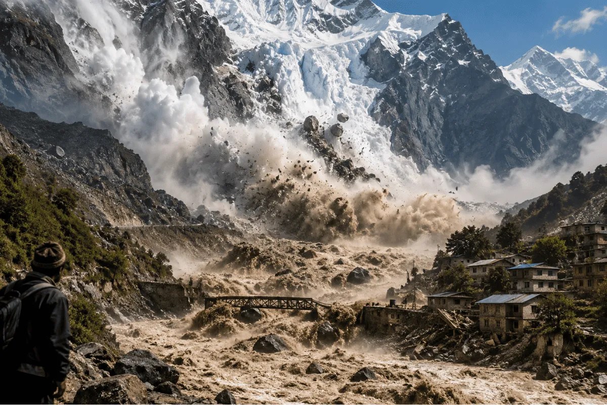
When a 600-meter-wide section of glacier and underlying bedrock sheared off from an altitude of 5,200 meters, it did not trigger a classic glacial lake outburst flood (GLOF) as initially hypothesized by local emergency responders. Instead, it was an immense direct mass-wasting event. The pulverized ice and rock mixed with debris, plummeting over 2,200 vertical meters into the narrow gorge below. Seismometers initially logged the impact as a magnitude 5.2 earthquake, tricked by the sheer kinetic force of millions of tons of material slamming into the valley floor. Within minutes, a slurry of mud, water, and boulders tore down the mountain paths at speeds exceeding 160 kilometers per hour.
The disaster laid bare a persistent structural failure in high-mountain risk mitigation. We possess the orbital technology to spot micro-fractures in remote glaciers from hundreds of miles above the Earth, but we lack the institutional architecture to pipe that intelligence down to remote river valleys in real time.
The Anatomy of a Missed Warning
Weeks before the catastrophic failure, remote sensing specialists studying high-mountain Asia noted anomalous shifts in the region. Sentinel, PlanetScope, and Gaofen-1 imagery highlighted areas where perennial snow cover rapidly gave way to bare, unstable ice. Meltwater pooling beneath the glacial tongue indicated that hydrostatic pressure was building up, acting as a lubricant against the bedrock.
The signals were legible to anyone trained in geomorphology. But observation is not protection.
In the hours immediately preceding the disaster, automated river gauges at Rasuwagadhi and Syafrubesi registered an unexpected drop in water levels. This drop was a textbook hydrological signature of an upstream blockage, as debris temporarily dammed the narrow channel before giving way to the catastrophic surge. Ground sensors designed to catch these anomalies either lacked telemetry links or were sparse enough to be bypassed entirely by the localized geography of the high Himalayas. By the time the sudden drop transformed into a towering wall of grey sludge, downstream communities had less than five minutes of actual warning—not enough time to run across a street, let alone evacuate a settlement.
Infrastructure Boom Meets Fragile Geology
The human toll of the disaster was magnified by a rush to monetize the rugged borderlands. Over the past decade, both Nepal and China have aggressively expanded high-altitude infrastructure, embedding roads, tunnels, and complex hydropower projects directly into narrow mountain corridors.
Hydropower facilities require proximity to steep river gradients to maximize energy generation, placing worker colonies and heavy machinery precisely where debris flows naturally concentrate. Following the catastrophe, preliminary assessments from the Nepal Electricity Authority revealed that over a dozen power projects were severely damaged or knocked completely offline, scrubbing hundreds of megawatts from the regional grid.
Living quarters for construction crews and local tourist hubs like Syapru Besi were built on flat alluvial fans—geological features that are, by definition, deposits of past catastrophic floods. When developers treat these high-risk zones as permanent urban spaces without engineering fortifications or strict setback zones, disasters cease to be natural anomalies and become manufactured outcomes.
The Climate Reality Beneath the Permafrost
While direct attribution studies take months to compute, glaciologists emphasize that the physical mechanisms driving these collapses are thoroughly tied to a warming atmosphere. Temperatures in the Himalayas are rising at nearly twice the global average. This thermal anomaly does more than just shrink surface ice; it reaches deep into the mountain’s structural skeleton.
Permafrost acts as deep-freeze cement, binding rock, ice, and soil together across sheer vertical faces. As ambient temperatures push zero degrees Celsius higher into the alpine zones, that cement thaws. Slopes that have remained stable for millennia suddenly lose their internal cohesion. The bedrock itself fractures, taking massive hanging glaciers down with it in events far larger than standard seasonal avalanches.
Traditional hazard mapping in the region has historically focused on GLOFs—bursting glacial lakes that fill valleys with water. Systems are built to monitor water levels in specific lakes perched behind terminal moraines. However, dry rock-and-ice avalanches bypass lake monitoring entirely. They originate from dry cliffs and steep rock faces, turning solid mountain mass into fluid kinetic energy instantaneously.
Bridging the Data Chasm
The satellite data exists. The scientific capability to model slope failure exists. The missing link is the operational pipeline connecting orbital analytics to local populations.
International groups like the High-Mountain Asia Team and various academic alliances routinely process satellite passes within hours of capture. Yet, this information sits behind institutional silos rather than feeding into automated sirens along transboundary river basins. Cross-border data sharing between upstream and downstream nations remains sluggish, bogged down by bureaucratic friction even as ecological shifts accelerate across geopolitical lines.
If regional authorities are to prevent future valleys from turning into mass graves, early warning systems must evolve past simple rain gauges and manual observation. They require automated ingestion of high-frequency synthetic aperture radar (SAR) data that can pierce through cloud cover and track surface displacement day and night. When software flags accelerating millimeter-scale shifts on a high-altitude cliff face, automated protocols must trigger immediate evacuation alerts downstream, long before the first ton of ice begins its fatal descent.