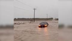
The real culprit behind the escalating Texas flood crisis is not just severe weather, but an aggressive, unchecked expansion of concrete pavement that has stripped away the state’s natural drainage systems, paired with a massive $54.5 billion infrastructure funding gap. Every time a heavy storm hits the Lone Star State, news cameras rush to capture dramatic footage of SUVs submerged in brown water and rescue boats navigating suburban streets. These broadcasts treat the rising water as an unpredictable act of God. It is not. The recurring devastation is the predictable result of decades of deliberate engineering and regulatory decisions that prioritized rapid suburban expansion over hydrological reality.
The Illusion of the Natural Disaster
The narrative is always the same. Local television anchors point to record rainfall totals, shake their heads at the power of nature, and interview displaced residents who wonder how this could happen again.
It happens because Texas is paving over its own exit routes for water. Between 1997 and 2017, the Houston metropolitan area alone added roughly 1,000 square kilometers of impervious surfaces like roads, parking lots, and rooftops. That is an area larger than the entire landmass of New York City, covered in a solid gray sheet that refuses to let a single drop of rain sink into the earth.
When rain falls on a natural grassland, the soil acts as a sponge. On concrete, that same rain becomes immediate, high-velocity runoff that overloads local bayous, creeks, and storm drains.
[Natural Grassland]  --> 90% Water Absorbed into Soil via Deep Roots
[Concrete Suburb]    --> 100% Water Becomes Fast-Moving Surface Runoff
This rapid transition from soil to asphalt has fundamentally rewritten the rules of regional hydrology. A peer-reviewed study by researchers at Princeton University and the University of Iowa revealed that Houston’s heavy urbanization increased its risk of extreme flooding during major storms by up to 21 times. The physical presence of tall buildings and suburban sprawl even creates a "drag effect" on coastal winds, stalling storms directly over populated areas and causing them to dump more water than they would over open country.
Yet, developers continue to build. Municipalities continue to approve permits. The state continues to expand highways, creating more runoff that inevitably finds its way into the living rooms of working-class neighborhoods.
The Pavement Paradox and the Clay Soil Excuse
For decades, flood control officials in Texas have pointed to the region's geography as the primary defense for their struggles. They claim the state is naturally flat and packed with thick clay soils that are naturally impermeable.
This defense is highly misleading. While Texas clay is denser than the sandy loam of other states, undisturbed native prairies are actually highly efficient water-management systems. Deep-rooted native grasses, such as Little Bluestem and Indiangrass, carve pathways deep into the clay, allowing water to infiltrate the ground far more quickly than modern lawns or compacted suburban soils.
When developers bulldoze these prairies, they scrape away the organic topsoil and compact the underlying clay with heavy machinery. This process transforms what was once a semi-absorbent ecosystem into a virtual parking lot, even before the first batch of concrete is poured.
Furthermore, the traditional engineering approach to managing this water is fundamentally outdated. For generations, the goal of Texas flood control districts was simple: channelize the water.
Natural, Winding Stream (Slow water, natural absorption)
       │
       ▼ (Human Intervention)
Straightened Concrete Ditch (Fast water, downstream flooding)
They took winding, natural creeks and turned them into straight, concrete-lined ditches. This does not solve the flooding problem; it merely moves the crisis downstream. By accelerating the speed at which water flows toward major rivers and bays, these concrete channels overwhelm downstream communities that lack the infrastructure to handle the sudden, massive volume of water.
The Fifty Billion Dollar Chasm
The scale of the infrastructure deficit is staggering. A comprehensive state report estimated that Texas needs at least $54.5 billion to fund necessary flood mitigation and management projects across its sixteen regional planning areas.
The state does not have this money on hand. While the Texas Legislature created the Flood Infrastructure Fund (FIF) in 2019 to help finance local projects, the program remains vastly underfunded compared to the actual need. The latest funding cycle for 2026-2027 offers just over $312 million—a mere drop in the bucket for a state with 5 million people living or working in flood-prone areas.
This financial shortfall is felt most acutely in rural and unincorporated areas. While major cities like Houston and Dallas have dedicated engineering departments and property tax bases to fund drainage improvements, rural Texas is left largely defenseless.
In many small towns, a single county official is forced to wear multiple hats. It is common to find one overworked individual serving simultaneously as the local fire marshal, building inspector, engineer, and floodplain administrator for hundreds of square miles. These communities do not have the technical staff required to perform complex hydrologic modeling, write federal grant applications, or enforce strict building standards. Consequently, they remain trapped in a cycle of rebuilding outdated, undersized culverts that wash out during every moderate storm.
Infrastructure Inequality and the Drainage Justice Gap
Flood mitigation is not distributed equally. In Texas, the quality of the drainage system under your feet is often determined by the value of the home you own.
Stanford University researchers studying flood resilience in historically underserved Houston neighborhoods documented a stark division in how infrastructure money is spent. Wealthier neighborhoods are increasingly benefiting from modern, aesthetically pleasing green infrastructure like bioswales, rain gardens, and urban retention parks. These features slow down water and improve local property values.
Meanwhile, historically redlined and lower-income neighborhoods are left with decaying, mid-century concrete systems that fail during minor, non-hurricane rainstorms. In these communities, residents report that just one or two inches of rain can cause knee-high water in their streets, trapping families in their homes and destroying vehicles.
Neighborhood Wealth vs. Flood Infrastructure Quality:
┌─────────────────────┬─────────────────────────────────┐
│ Wealthy Districts   │ Rain gardens, retention parks   │
├─────────────────────┼─────────────────────────────────┤
│ Low-Income Areas    │ Clogged ditches, broken culverts│
└─────────────────────┴─────────────────────────────────┘
This disparity is exacerbated by the way federal and state funding is prioritized. Most grant programs evaluate projects based on a benefit-cost analysis that weighs the monetary value of the property protected against the cost of the project. Under this formula, protecting a single million-dollar home in an affluent suburb generates a higher score than protecting five homes worth $100,000 each in a working-class urban neighborhood.
This systemic bias ensures that the communities least able to afford the cost of rebuilding are the ones left most vulnerable to the next storm.
The Broken Cycle of Federal Relief
The federal response to this ongoing crisis has only reinforced bad behavior. Rather than incentivizing proactive relocation or structural retrofits, federal disaster policy has historically funded a costly cycle of rebuilding in place.
For every dollar the Federal Emergency Management Agency (FEMA) spends on voluntary property buyouts to move families out of harm's way, it spends vastly more money rebuilding structures in the exact same floodplains. This reactive model keeps vulnerable residents trapped in repetitive-loss properties, waiting for the next inevitable disaster to ruin their homes and lives.
The federal programs designed to break this cycle are currently facing political and bureaucratic bottlenecks. Major pre-disaster mitigation programs, such as Building Resilient Infrastructure and Communities (BRIC) and Flood Mitigation Assistance (FMA), have faced administrative delays and funding uncertainties.
Without robust federal support and strict state-level land-use reform, local communities are left to fight a losing battle against gravity and water. The state's climatologist estimates that extreme one-day precipitation in Texas has already increased by up to 15% since the late 20th century, with another 10% increase projected by 2036.
Texas cannot build concrete walls high enough to outrun this reality. Until state and local leaders confront the real-estate lobby, mandate lower limits on impervious cover, and invest heavily in restoring natural floodplains, the state will continue to drown under the weight of its own growth.