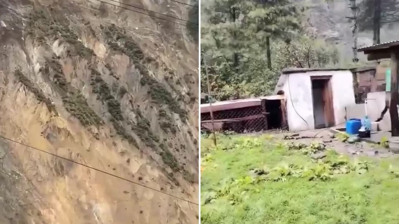
The Physics of Rapid Mass Wasting
When a section of an alpine slope detaches and transitions from static equilibrium to kinetic ruin in seconds, observers often perceive a sudden, unpredictable anomaly. Geotechnical engineering reveals a different reality. Slope collapse represents the terminal threshold of a continuous mechanical degradation process. In high-relief tectonic zones, gravity continuously exerts shear stress against the internal shear strength of rock masses and regolith. When external environmental inputs—such as intense precipitation, seismic tremors, or toe erosion from river currents—elevate shear stress beyond material resistance, failure occurs instantaneously along pre-existing structural discontinuities.
The Stress-Strain Mechanics of Alpine Slopes
Understanding why a mountain flank fails catastrophically requires examining the fundamental equation of slope stability, expressed through the factor of safety. The factor of safety is the ratio of resisting forces to driving forces. Resisting forces derive from internal friction and cohesion along potential slip surfaces. Driving forces stem primarily from the gravitational component parallel to the slope face.
The Role of Pore Water Pressure
Water serves as both a weathering agent and a mechanical destabilizer. As moisture infiltrates jointed rock and loose regolith, it increases pore water pressure. This internal fluid pressure acts against normal stresses, effectively reducing intergranular friction and total shear strength. In steep river valleys, seasonal monsoonal precipitation or glacial meltwater infiltration creates transient perched water tables. These tables exert outward hydraulic gradients that push fractured rock masses outward, converting stable earth into liquefied or sliding debris.
Lithological Heterogeneity and Structural Discontinuity
Rock masses are rarely homogeneous. They feature joints, fault planes, foliation, and bedding orientations that dip unfavorably toward free faces. When water enters these discontinuities, hydraulic wedge effects occur. Hydrostatic pressure within narrow fractures widens gaps, lowering cohesive bonds to near zero. Once the critical threshold of tensile strength is exceeded at the base of a cliff or valley wall, the overburden separates with minimal warning.
Hydraulic Impedance and Secondary Hazard Cascades
The collapse of mountain flanks directly into confined river channels initiates a complex secondary hazard sequence. When millions of cubic meters of rock and sediment plunge into a waterway, the immediate physical outcome is mass flow blocking.
The Formation of Natural Damming
The sudden introduction of high-volume debris creates an instant landslide dam. This obstruction halts downstream discharge, forming an impounded lake upstream. The hydraulic head behind the newly formed barrier increases exponentially with every hour of blocked flow. Because landslide dams are typically composed of unconsolidated, poorly sorted material rather than engineered earthworks, they possess extremely low structural integrity.
Catastrophic Breach Dynamics
Overtopping is the primary failure mechanism for natural dams. As the upstream water level breaches the crest of the landslide mass, rapid erosion cuts a channel through the loose debris. The resulting breach drives a catastrophic downstream surge—a hyperconcentrated debris flow or outburst flood that scours riverbanks, destroys downstream settlements, and reshapes valley geomorphology for kilometers. The sounds captured in viral footage are not merely atmospheric soundwaves of falling rock, but the acoustic signature of high-velocity frictional shearing, acoustic fluidization, and immediate hydrodynamic shockwaves.
Diagnostic Indicators and Predictive Modeling Limitations
Forecasting the exact temporal window of a catastrophic slope collapse remains one of the most challenging problems in earth sciences. While movement rates typically accelerate prior to failure—following creep deformation phases characterized by tertiary creep curves—the transition from slow displacement to runaway velocity often happens within minutes.
Creep Monitoring and Displacement Velocity
Geodetic instruments, radar interferometry, and extensometers measure surface deformation vectors. When displacement rates transition from steady-state secondary creep to accelerating tertiary creep, failure is imminent. However, predicting the exact second of detachment is constrained by subsurface invisibility. Critical failure planes develop deep within the rock mass where direct sensors cannot reach. Consequently, analysts rely on inverse velocity models, plotting the inverse of surface velocity against time to project the intersection point where velocity approaches infinity.
The Limitation of Regional Hazard Maps
Susceptibility mapping identifies zones prone to mass wasting based on slope angle, lithology, precipitation indices, and historical inventories. While these models effectively demarcate high-risk corridors across regional scales, they fail to provide deterministic temporal warnings. A slope with a low static factor of safety may remain metastable for centuries until a precise, unquantifiable trigger—such as an isolated root-zone saturation event or a micro-seismic shock—initiates the cascading collapse.
Operational Risk Mitigation and Structural Intervention
Managing hazard exposure in active tectonic environments requires shifting from reactive disaster response to continuous geotechnical monitoring and engineered adaptation. Traditional structural countermeasures—such as rockbolts, shotcrete applications, retaining walls, and drainage tunnels—are economically and logistically unfeasible across thousands of square kilometers of towering Himalayan terrain.
To protect vulnerable transportation corridors and riverside settlements, agencies must deploy integrated sensor arrays combining continuous ground-based radar, acoustic emission monitors, and automated hydrological level sensors upstream. When slope velocity exceeds empirical safety thresholds, automated early-warning telemetry must trigger immediate evacuation protocols along downstream flood zones. Simultaneously, land-use planning must restrict permanent infrastructure development within runout zones and historical alluvial fans. The capacity to withstand rapid geomorphic change depends entirely on acknowledging that high-relief environments are inherently dynamic, requiring continuous risk discounting rather than permanent structural resistance.